Features
Terrain
Mountain ranges raised and eroded per seed, with geology, river networks, coasts and lakes; non-destructive height brushes; terrain data maps.
- Mountain generation (
TerrainGenerator3D:uplift,ranges,erodibility,critical_slope,detail_wavelength,detail_octaves,detail_crest): raises ranges from an uplift map, Path3D ranges and noise, then erodes them to equilibrium with stream power erosion; branching gullies come from an erosion filter computed per point, so tiles join exactly; on crests gullies keep part of their depth and a ridged noise adds irregular pinnacles; the same for a seed; writes into Terrain3D or a HeightMapShape3D. - River deposition (
deposition, off by default): rivers drop sediment where they slow (Yuan et al. 2019), building flat alluvial valley floors. - Coarse-to-fine erosion (
coarse_levels,refine_steps): about 3.7 times faster at 4 m cells, with the same relief. - Tile erosion (
tile_erosion_enabled): droplet hydraulic and thermal erosion in seamless overlapping tiles. - Material detail (
get_detail_shader_code()): erosion detail below the vertex spacing in the terrain material; path tracing keeps it. - Rock layers and waterfalls (
strata_enabled,get_waterfalls()): hard and soft bands that rivers cut into caprock waterfalls. - Rivers fed by rain and snowmelt (
climate_recipe,river_month): a monthly water balance from the climate sets each river’s flow, month by month. - Geology maps (
terrain_geology()in shaders): soil, bare rock and scree from the erosion run. - River network (
build_river_paths()): rivers with widths and discharges, made into joinedPhysXRiver3Dpaths. - Coast and lakes (
ocean_edgesorsea_map;lake_count,lakes;build_water()): sea with a Dean-profile seabed and beaches; lakes behind natural dams or rock lips that spill as waterfalls; builds the sea and lake surfaces, and rivers end in them. - Climate maps (
TerrainDataMap3D.bake_climate(),ClimateRecipe): temperature, orographic rain and rain shadows, snow share, aridity, winter and annual sunlight with terrain shadows, and wind exposure. - Ground material (
TerrainMaterial3D,use_generator()): rock, scree, soil, alluvium and sand from the generator’s geology, height-blended, biplanar cliffs, erosion detail, wetness and snow. - Landscape3D (
source,spacing,lod_error): heightfield ground from a TerrainGenerator3D or a height image, as chunk meshes with crack-free LODs and one BLAS per chunk level, so nothing rebuilds while the camera moves. - Footprints in ground (
GroundSurface3D,BaseMaterial3D.ground_deform_enabled): prints in sand, soil, mud and leaf litter; moisture from the weather map, walls slump to the angle of repose. - Terrain deformation (
TerrainDeformer3D,TerrainBrush3D): non-destructive height brushes (rivers, craters, plots) over Terrain3D or a height map; moving a brush restores the ground. - Terrain data maps (
TerrainDataMap3D): bakes slope, curvature, water flow, wetness, water depth and distance to water around a point, for placing plants and for materials; a 512 map bakes once in about 0.2 s.
Images#
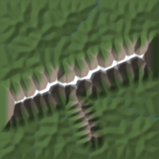
Mountain generation: ridges, valleys and the rivers that carved them, from one seed.
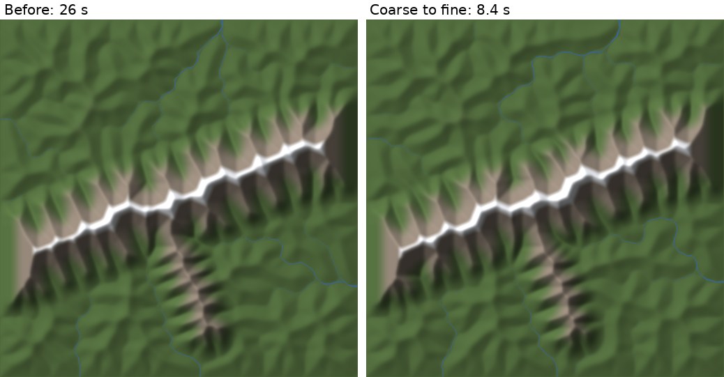
Coarse to fine: the same relief at 8 m cells in a third of the time.
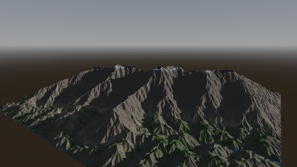
Mountain generation: branching gullies down every slope.
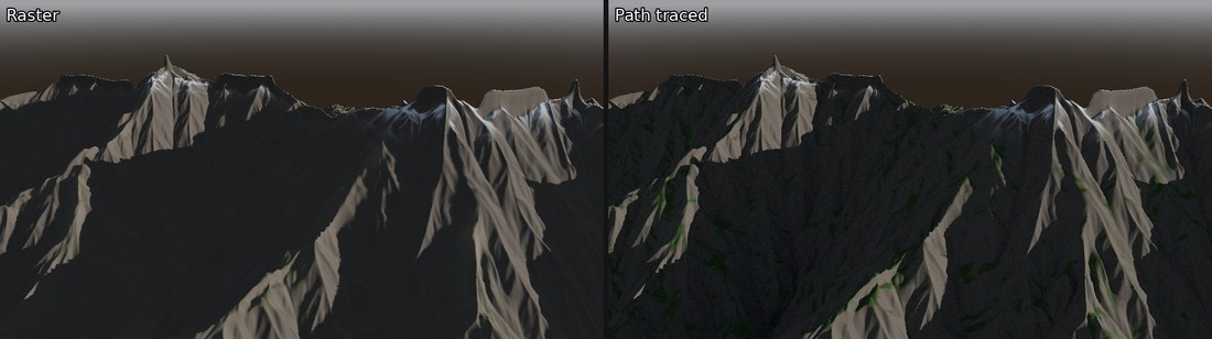
Mountain generation up close, raster and path traced.
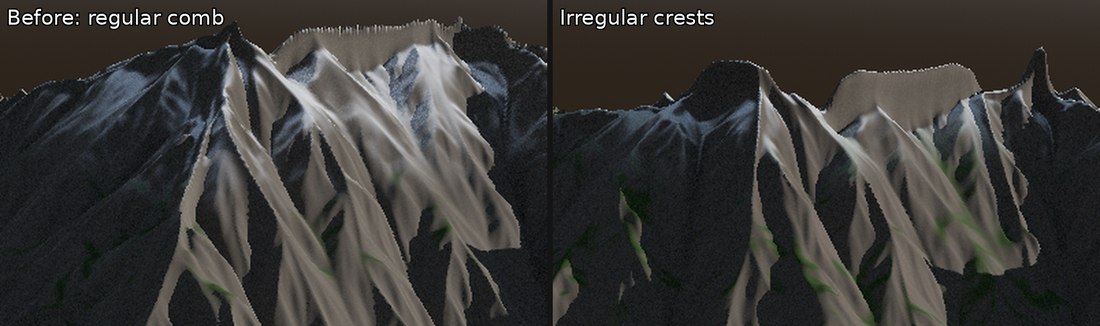
Crests: before, a thin regular comb along the summits; now, irregular crests and pinnacles.
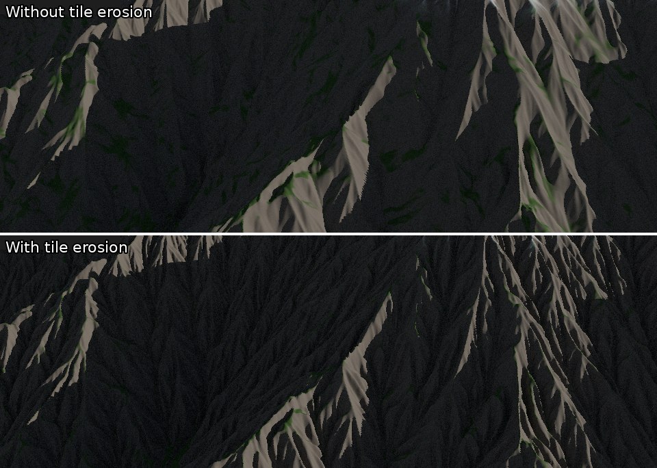
Tile erosion: fine branching rills cut into every slope.
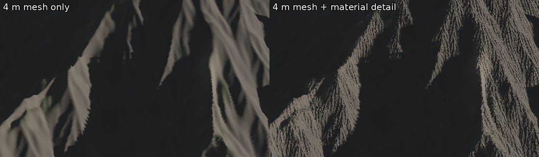
Material detail: rills finer than the 4 m mesh, drawn by the material.
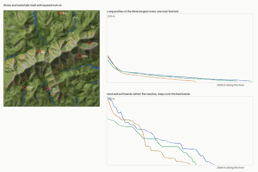
Rock layers: rivers step down over the hard bands, leaving waterfalls up to 30 m.
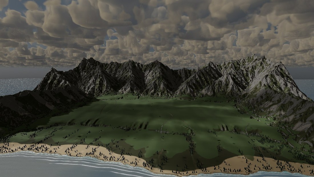
River deposition: the rivers fill the valley between the ridges with a flat alluvial floor.
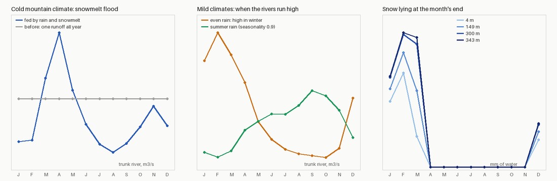
Rivers by month: a spring snowmelt flood in cold mountains, winter or summer high water in mild climates.
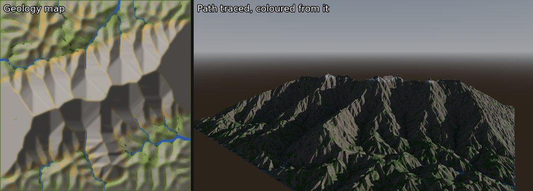
Geology: soil green, bare rock grey, scree ochre, rivers blue; the shader colours the range from the map.
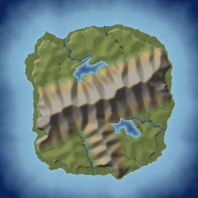

Coast and lakes: beaches, a shelving seabed and lakes behind dams, from one seed.
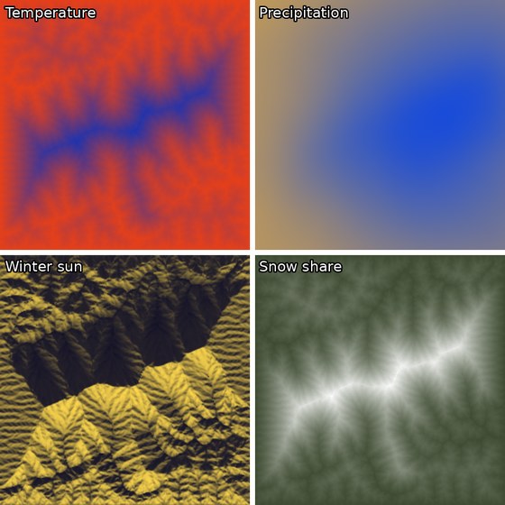
Climate maps: cold high ridges, rain over the range, shaded faces in winter, snow on the high crest.
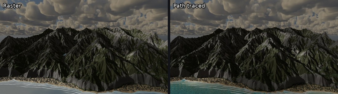
Ground material: rock on crests and cliffs, grass and soil on the slopes, a sand beach at the coast, all from the generator’s geology.
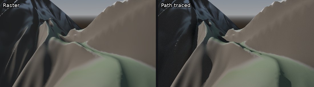
Landscape3D: a 1 m heightfield with sharp ridges and a narrow valley floor, the same in raster and path tracing.
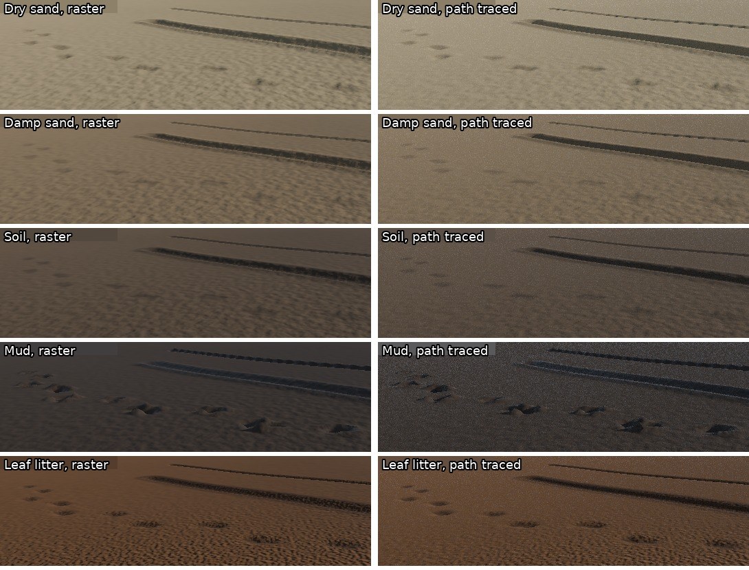
Footprints: deepest in mud, shallow in dry sand where the walls slump.
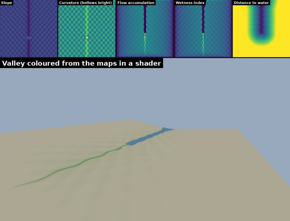
Terrain data maps: the stream bed, wet ground and banks come from the maps alone.